Sport
Randonnée - Les deux vallées
Matafelon-Granges
Description
01580 Matafelon-Granges
Ain (1)
Informations complémentaires
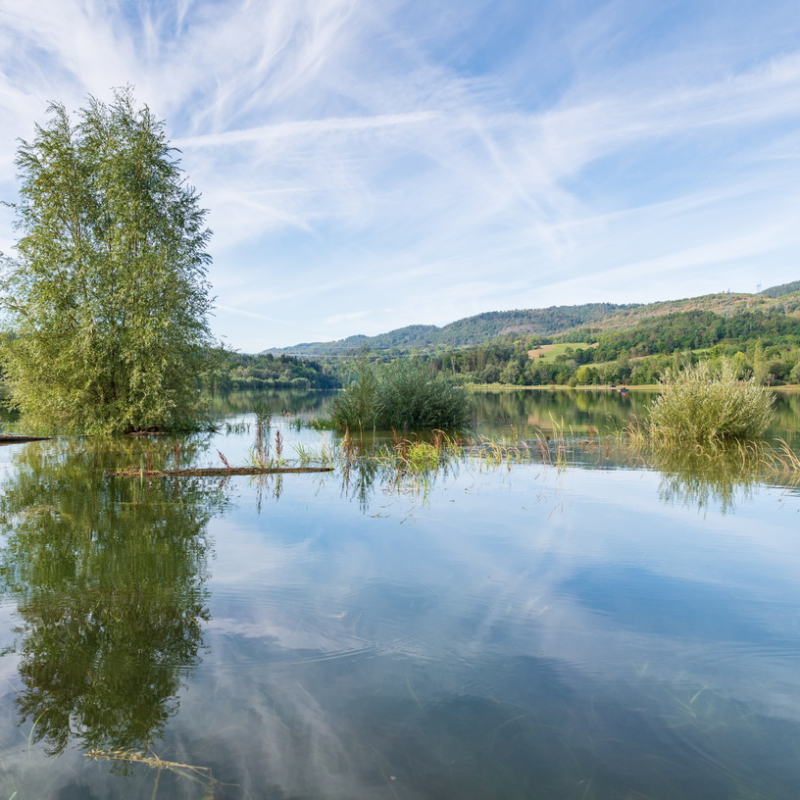
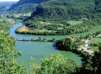
This hiking path is marked out in yellow. The starting point is at the lake of Oignin's edge. After reach the pass of Matafelon, the path runs into the forest. The path carry on until Coiselet, near to the Ain river. Next, the path follows the Oignin river until the hamlet of Charmines and the lake.
OuvertureAccès libre toute l'année.
TarifsGratuit
Topoguide en vente à l'Office de tourisme (1 €).
Contact et accès Rue du lac01580 Matafelon-Granges
Ain (1)
Informations complémentaires
À proximité
Viewpoint
Belvédères de la chapelle de Saint Maurice d’Echazeaux
Corveissiat
Camper van service/reception area
aire d’Izernore
Izernore
Museum
Archaeological Museum
Izernore
Sports and leisure
Tour de l’Ain – Etape 3 par les Monts Berthiand
Izernore
Traditional cooking
Restaurant Michaillard -Pizza Léonard
Izernore
Hotel - restaurant
Hôtel Au Moulin du Pont
Samognat
Shops
Atelier de cannage – paillage
Izernore
Traditional cooking
Au Moulin du Pont
Samognat
Campsite
Camping Paradis Les Gorges du Haut-Bugey
Matafelon-Granges
Shops
Bar du Moulin du Pont
Samognat
Cultural
Exposition – Truelle et Caducée : Archéologie du Soin et de la Santé
Izernore
Cultural
The Stone Path
Izernore