- View of the Chaîne des Puys, the Sancy massif and the banne d'Ordanche.
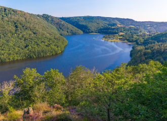
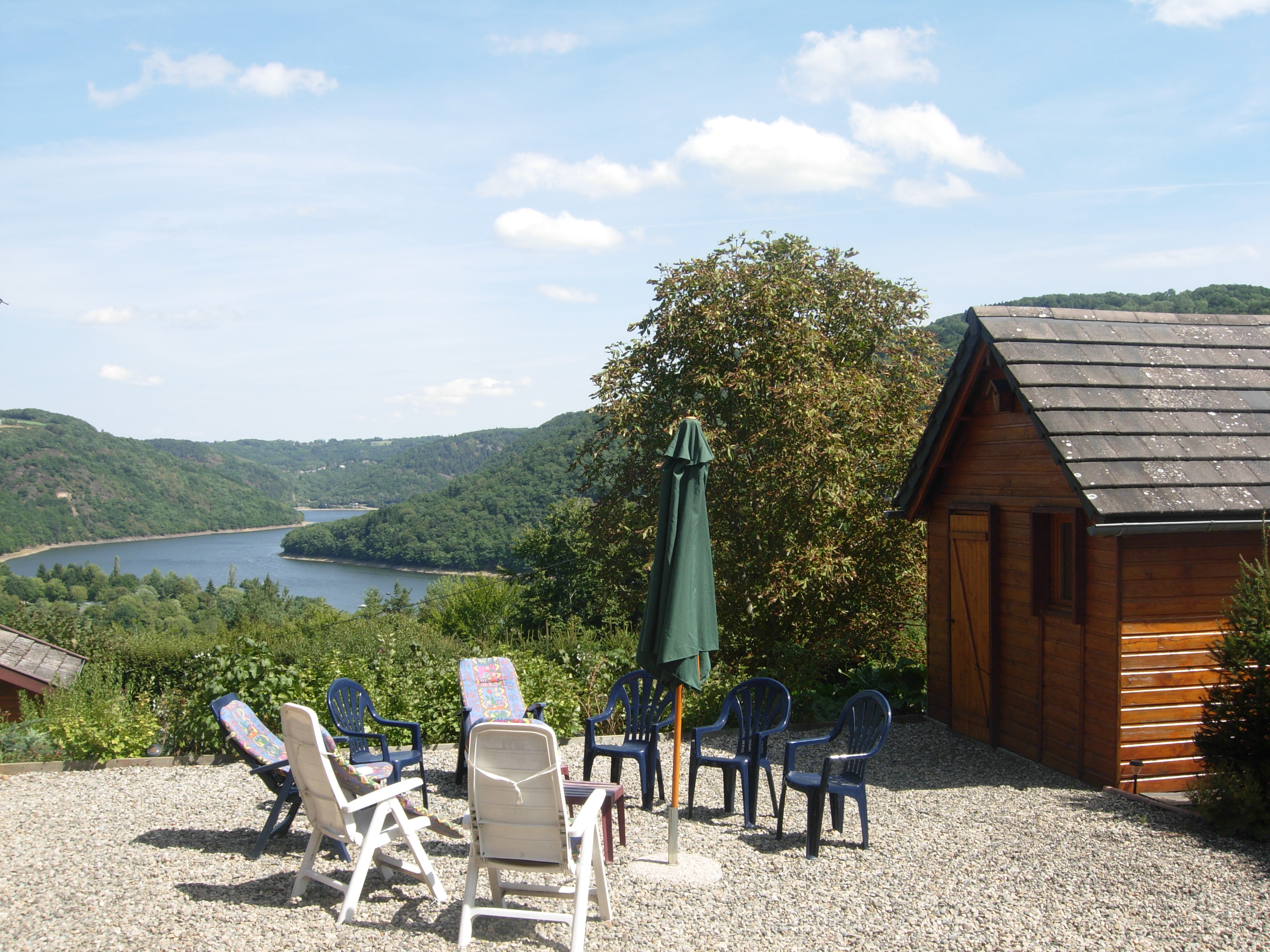
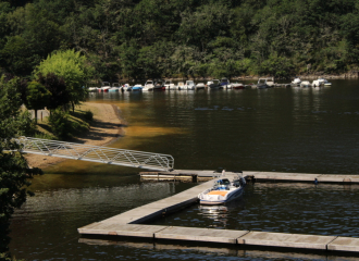
- View of the Fades reservoir.
- Small heritage features (cross, wash-house...).
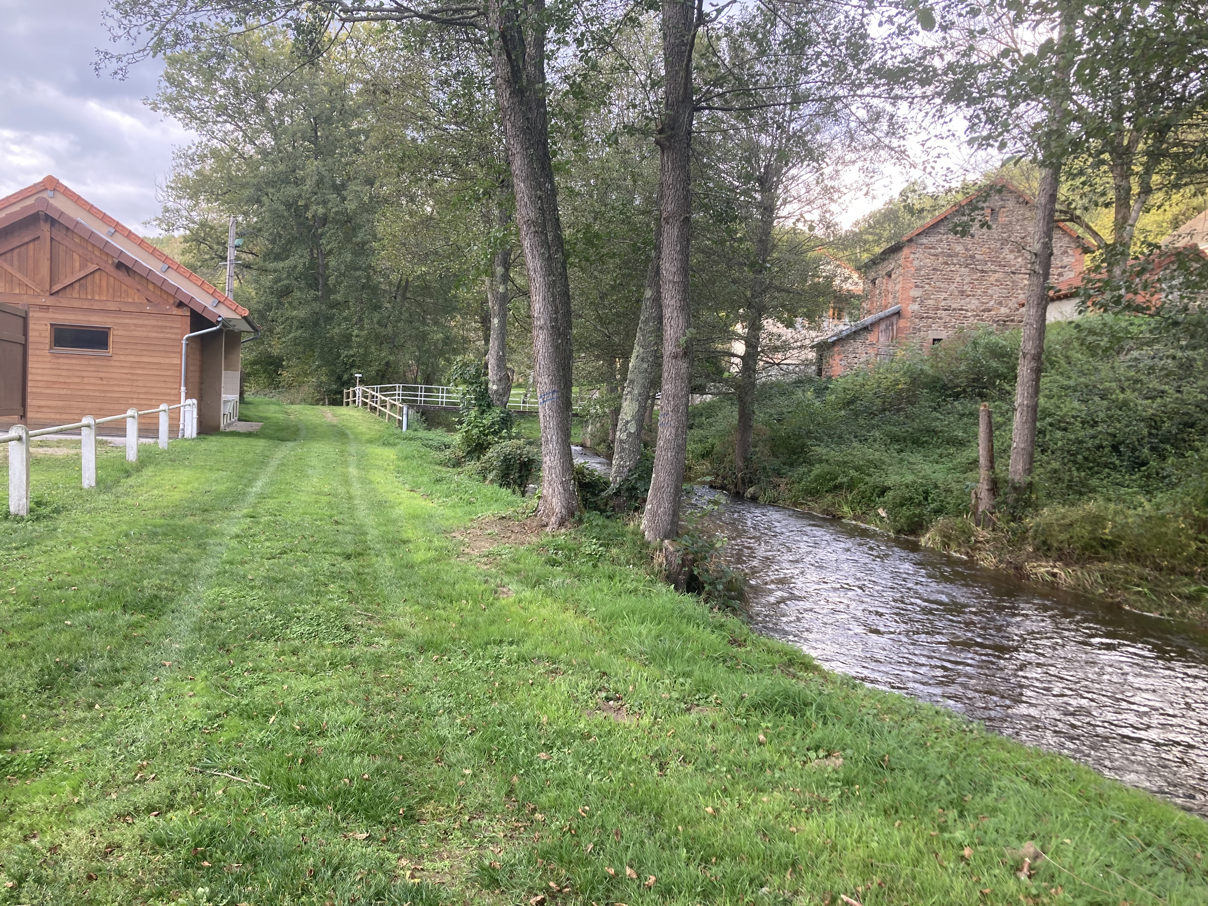
- Forest and stream.
Guidebook with maps/step-by-step
1/ From the start sign, take the road towards Les Berthons. Turn right at the fork, then left at the next crossroads. 150 m after the Auberge de la Hulotte, take a track on the left into a wood. Follow it to the edge of the wood, ignoring the side paths. Turn left onto a track between two low walls. Walk along the edge of the wood, leaving a grassy path on your right (view of the Chaîne des Puys, the Sancy massif and the Ordanche banne). Continue until you reach a crossroads at the entrance to Les Berthons. Go down a damp track opposite. At the tarmac road, turn left. At the crossroads at the end of the hamlet (stables of the equestrian centre opposite), follow a track to the left until you reach the first track on the right (GR).
2/Take this and go down into the woods on a wide gravel track for about 1.5 km. Turn left onto a track leading to the Chazotte leisure centre. Take the road opposite up to the D121.
3/ Follow the D121 to the right for 250 m and climb to the left (with a view of the Fades reservoir) as far as the hamlet of La Chazotte. Cross the hamlet and continue straight on to the hamlet of La Barre.
4/ Turn left along the couderc (cross, wash-house, drinking trough) and at the crow's feet, turn left down the road. At the entrance to the La Barre sectional forest, follow a wide track to the left. Go straight ahead at the fork in the road and, at the junction of four tracks, head downhill. Cross the ruisseau des Côtes and climb up its right bank through a coniferous wood. At the T-junction, turn left onto a wide forest track as far as the D61 (picnic area).
5/ Cross the road to Martinèche. At the T-junction at the exit, turn left, then left again along a dirt track. At the crow's-foot (picnic area), go straight ahead. Cross a road, follow the D61 and then go into the woods. At the first crossroads go straight on, and at the second turn left to return to Saint-Jacques-d'Ambur.
Ouverture
All year round.
Subject to favorable weather.
Tarifs
Free access.
Contact et accès
Parking - Église
63230 Saint-Jacques-d'Ambur
Puy-de-Dôme (63)