A savoir :
- Une interprétation de l'abbé Bayle, trouvée dans ses écrits dit : «la teinte rougeâtre de ses rocs lorsqu'ils sont éclairés par les derniers rayons du soleil, aurait donné le nom au massif des Grandes Rousses ».
- Vous apercevez la cascade de la Fare, descendant la montagne depuis le lac du même nom situé à 2800m. Vous pourrez vous rendre à la cascade à pied lors d'une prochaine randonnée facile.
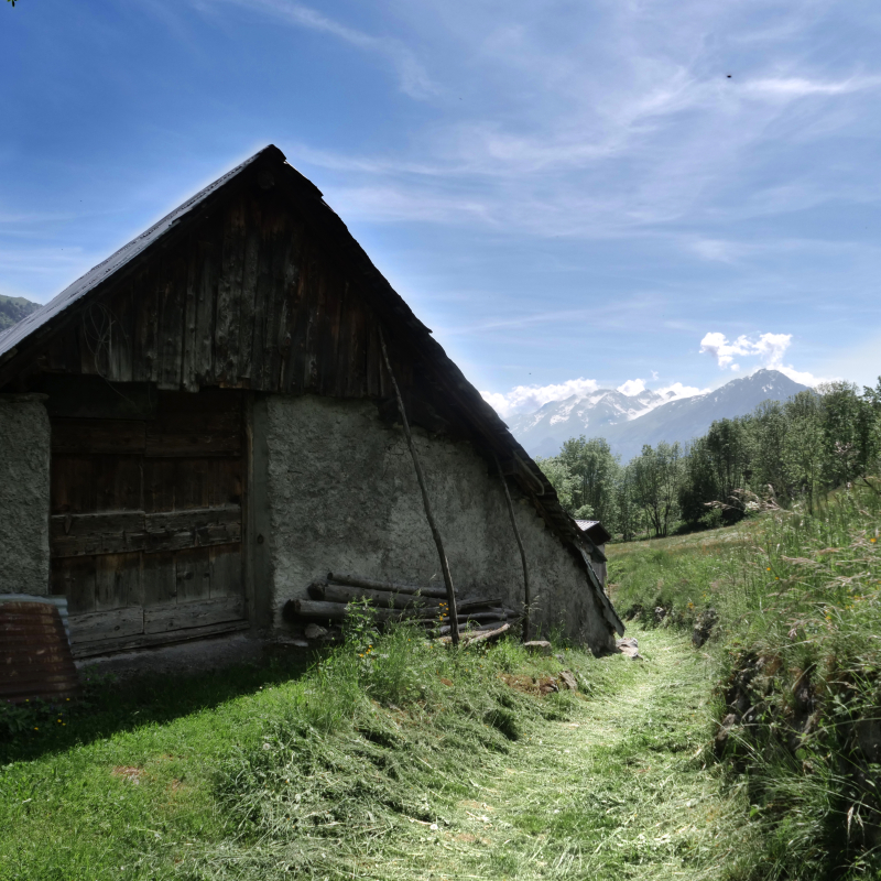
- De chaque côté du sentier vous apercevez des clapiers : murets de pierres sèches. Les pierres étaient dégagées des champs pour favoriser les cultures de seigle, d'orge, avoine, patates ou encore du chou. Ces murs délimitaient les champs et les propriétés.
- En 1900, Vaujany comptait 1000 habitants qu'il fallait nourrir à l'huile de coude et la sueur du front, ne pouvant compter sur rien d'autre !
L’élevage et la culture constituaient les métronomes de cette vie. « Il y a un temps pour naitre et un temps pour mourir, un temps pour planter et un temps pour récolter ».
On cultivait jusqu'à 1500m d'altitude. Le moindre bout de terre était exploité. Pour gagner des champs, l'on brulait les forêts faisant ainsi fuir bêtes y ayant élu domicile. De là provient le nom de bruleur de loup (nom emprunté par l'équipe de Hockey de Grenoble).
- Les tâches étaient naturellement réparties en fonction des saisons. Dès le printemps, on portait la terre, celle qui avait glissé durant l'hiver, emportée par la neige. À dos d'homme la terre était remontée dans les champs. On faisait la feuille aussi : on dégageait les pousses de hêtres, on en faisait des fagots, les feuilles servant à nourrir les bêtes ou et le bois à allumer le feu.
Vous dominez maintenant le hameau de La Villette, signifiant petite ville. La randonnée passe au retour dans ce hameau.
Guidebook with maps/step-by-step
From the tourist office square, head towards the road, in the direction of the bakery. Before the bakery on the right there is a small alleyway leading upwards. Take it. Always take the uphill path on the left. At the top, you will see the sign for Chemin de l'étendard. Turn right and you will reach the road. Continue uphill. Leave the road to Rochas and in the bend an alley goes straight on, called the "grand chemin", follow the yellow markings. Follow the main road again, up to the top. There, in front of you, a path in the grass goes ahead of you, yellow signs indicate the beginning of the path towards La Villette. Follow this well-marked path through the fields. Continue straight ahead, you arrive at the top of the hamlet of La Villette. You continue following the wooden signs, indicating the Collet. When you arrive at the Collet, you will find a restaurant, and behind a pump track, you follow the road behind, downhill. The road continues, and go straight downhill, you always follow this road track, until the intersection where you find yellow signs indicating Vaujany, La Villette and plan du moulin. You take this direction, on the right. You enter the hamlet of La Villette by the mill. Then you continue, to arrive in the heart of the village, the common oven on the right. The centre of Cote Belle is on the left, at the entrance to the village. Take the time to walk through the hamlet via these small streets. To return to Vaujany, take the road, and at the end of the hairpin bend take the path down to the left. It takes you back to the bottom of the resort. To return to the tourist office, turn right, the loop is complete!
Ouverture
From 01/06 to 31/10.
Subject to favorable weather.
Tarifs
Free access.
Contact et accès
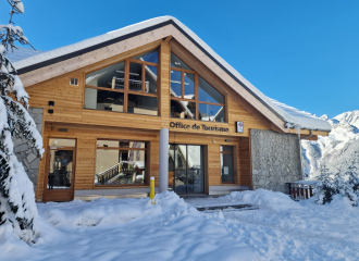
Départ Office de Tourisme de Vaujany
38114 Vaujany
Isère (38)