


Sport
Le Platary
Chichilianne

Description
38930 Chichilianne
Isère (38)
Informations complémentaires
A beautiful out-and-back hike through the typical Vercors mountain pastures. This quick outing can easily be enjoyed by the whole family.
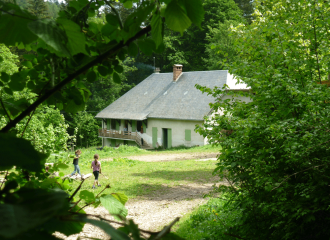
Guidebook with maps/step-by-stepDeparture : Park your car at the Col du Prayer parking lot. You'll find a picnic area and a parking lot. Look for the yellow sign indicating the start of your walk, entitled "Col du Prayer".
1) From the "Col du Prayer" post, follow the signs for "Les Sagnes" along the road on your left. A few hundred metres further on, you'll find the post.
2) From the "Les Sagnes" post, follow the signs for Le Platary by taking the path leading up to the right. This little path runs through a forest, climbs steeply and allows you to gain height very quickly. Later, you'll leave the forest and find yourself at the start of a beautiful alpine pasture. You'll find the following sign.
3) From the "Les Fayolles" signpost, head back in the direction of Le Platary. You're not far from the summit. You'll have to cross the mountain pasture (if there's a flock of sheep, remember to go around it without disturbing them). The path is difficult to see, so be careful and make sure you're always on the right track by following the signs. You'll soon reach the summit, where you'll find the Trièves in front of you and the magnificent cliffs of the Vercors behind.
4) To get back down, take the same route. First pass through the mountain pasture, then pick up the forest track that takes you directly to the road at "Les Sagnes". Turn left towards "Col du Prayer", where you'll find your car.
All year round.
Subject to favorable weather.
Free access.
Contact et accès Col du Prayer38930 Chichilianne
Isère (38)
Informations complémentaires
Ça peut vous intéresser


À proximité

Isère Cheval Vert
MMAVT
D.BARRIERE
Plantamarine
L. CASSAR
Isère Cheval Vert
O.Zanardi
Isère Cheval Vert

Sporting activities
Ferme équestre des 4 chemins à Chichilianne dès 4 ans
Chichilianne
Organic Farming (AB)
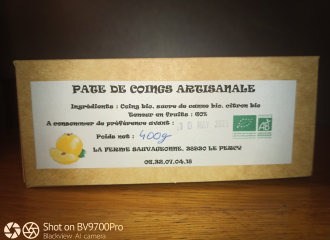
La Ferme Sauvageonne
Percy

Shops
L’Ecopain
Chichilianne
Leisure
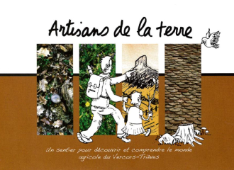
Sentier des Artisans de la Terre
Chichilianne
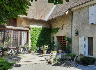
Bed & breakfast
Les Vagabonds du Mont
Chichilianne
Cultural activities
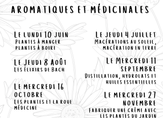
Stage Plantamarine Paysannes Herboristes
Le Monestier-du-Percy
Refuge
Refuge de l’Esparron
Percy

Natural wonder
Arbre remarquable : épicéa en symbiose sur un saule
Chichilianne
Group gîte
Ferme Equestre des 4 chemins
Chichilianne

Cultural activities
Atelier Couture DIY
Chichilianne

Mountain
Mont Aiguille
Chichilianne
Sporting activities
Bulle de Cheval – équicie
Le Monestier-du-Percy
